|
| Go back to the previous
page |
Hail and Hailstorms
October 25, 2003 – Hail in Suburbia
Sydney is ideally located for episodes of severe weather during spring and summer. Located far enough south to be impacted by dynamic mid-latitude weather systems, Sydney’s coastal location and proximity to the warm waters of the coral sea provides a volatile atmospheric mix.
In this regard, October 25 was a classic severe weather day in the harbour city. The surface air mass was very unstable with humid east to northeast winds and heavy cloud cover. A clearing in the cloud cover during the late morning, allowed for some daytime heating of the soupy lower atmosphere – the atmosphere was simmering! At the same time, an approaching upper trough would result in cooling of the mid levels of the atmosphere. The net effect would be enough to bring our atmospheric soup to the boil – such a dramatic destabilisation of the atmosphere during the early afternoon resulted in the rapid development of a severe thunderstorm over the ranges west of Sydney.
Jimmy Deguara and Geoff Thurtell decided the time was right to chase at the sight of a powerful side anvil emerging from the low level cloud, visible from Schofields just after noon. Chasers Jeff Brislane and Matt Piper were in position near Penrith to intercept the storm as it would enter Sydney’s western outskirts. Brett Vilnis and Mick Pollard chase the storm from the northern side, while David Croan is positioned on the eastern flank – this particular storm was well covered by Sydney’s storm chasers!
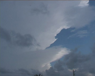
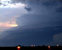
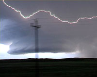
Above: (looking west from Schofields) A crisp continuous side anvil and low level inflow suggests that this storm is already severe.
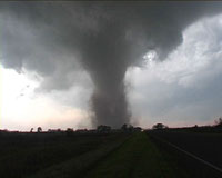
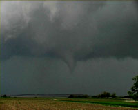
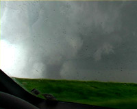
This classic supercell moving east north east, produces several rotating wall clouds and funnels as it tracked over the outer western suburbs. Jimmy Deguara and Geoff Thurtell shoot video of the impressive base. Meanwhile, Jeff Brislane and Matt Piper intercept the storm and enter a violent hail core that produces hail to tennis ball size.
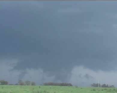
Above: wall cloud lowers. Tennis ball hail was falling behind this, causing major damage to property in northwest Sydney.
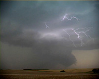
The chasers remain in constant contact during the afternoon commencing with Jeff and Matt’s report of giant hail in North Penrith. Jimmy and Geoff who manage to stay on the northeast flank, shoot video of the now left-moving supercell.
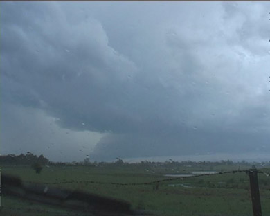
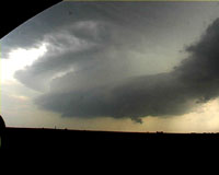
Above: looking south while under strong inflow into supercell
Further east, David Croan shoots high contrast footage of the approaching barrel updraft and beavertail oriented along the storms pseudo warm front. David manages to avoid a close encounter with the core on Old Northern Road near Glenorie, with only 3 cm hail falling near Dural.
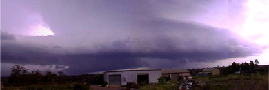
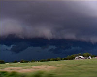
Above: looking east at Supercell base and updraft from Middle Dural in northwest Sydney.
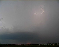
The storm assumes more of a high precipitation supercell structure and moves north out of the metropolitan area. More storms develop over northwest Sydney producing spectacular lightning.
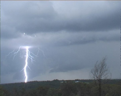
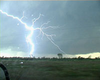
Above: CG lightning in northwest Sydney – a danger from all storms whether severe or not
A severe electrical squall line moves in from the west. Despite an hour having passed since the storm tracked over the Rouse Hill area, there remained some impressive hail-drifts. Hailstones to 5cm in diameter were measured in this area. Eyewitness accounts later reveal that hail to 7cm fell near Penrith, with possibly the largest hail falling in Riverstone, on Sydney’s northwest suburbs. The storm caused a considerable amount of damage mostly due to hail and also high winds.
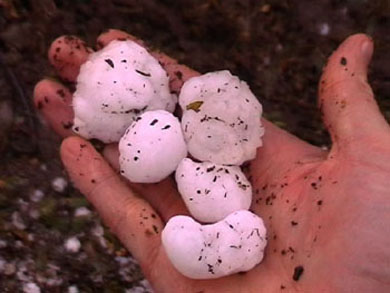
Above: Large hailstones collected from Rouse Hill in Sydney.
| Go back to the previous
page | top |
© 2001-2009 Thunderbolt Tours
|
Hail Size:
|
Size [cm]
|
Descriptive term
|
|
0.3
|
Pellet, rice
|
|
0.5
|
Small hail
|
|
1.0
|
Pea, musket ball
|
|
1.5
|
Cherry, grape, nutmeg
|
|
2.0
|
Marble, lark egg, gooseberry, bullet, Australian 5 cent coin
|
|
2.2
|
Australian 10 cent coin
|
|
2.7
|
Australian 20 cent coin
|
|
3.0
|
Australian 50 cent coin
|
|
3.5
|
Table tennis ball
|
|
3.7
|
Walnut
|
|
4.0
|
Pigeon egg
|
|
4.2
|
Golf ball, goose egg
|
|
5.5
|
Chicken egg, pullet egg, duck egg
|
|
6.0
|
Billiard ball
|
|
6.3
|
Tennis ball
|
|
7.0
|
Cricket ball
|
|
8.0
|
Fist, orange
|
|
10.0
|
Grapefruit
|
|